Geropotamos Beach: The Honest Guide to the River-Mouth Sand Near Panormo
A long, mostly wild beach under the highway bridge three kilometres west of Panormo, where a river that runs all year meets the sea — magnificent on a calm day, a surf beach when the north wind blows.
Geropotamos is the beach the Panormo crowd drives to when the village cove feels small: a long stretch of mostly wild sand under the highway bridge, three kilometres west of the village, where a river that carries water all year pools behind the shore and then runs into the sea. On a still morning it is one of the best-looking beaches on this coast. On a meltemi afternoon it is a surf beach with red flags. Distances, access and conditions below come from published beach listings, checked in September 2026; the beach is described from our own visits.
The honest facts
- Where
- about 18 km east of Rethymno and 3 km west of Panormo, directly below the national road bridge (sources range from 17 to 19 km from Rethymno).
- Access
- leave the highway at the bridge; a short dirt road leads to parking on the far side. Coastal buses pass on the highway, but there is no confirmed stop.
- The beach
- mostly sand, pebbly and rocky in places; the river forms a small lagoon at the eastern end before it meets the sea.
- Organisation
- a small section with umbrellas, a canteen and toilets in season; the rest is free and without shade.
- The water
- deepens fast, cold near the river mouth, and fully open to the north wind — big waves on meltemi days.
- Nature
- the river mouth and wetland sit inside a Natura 2000 area.
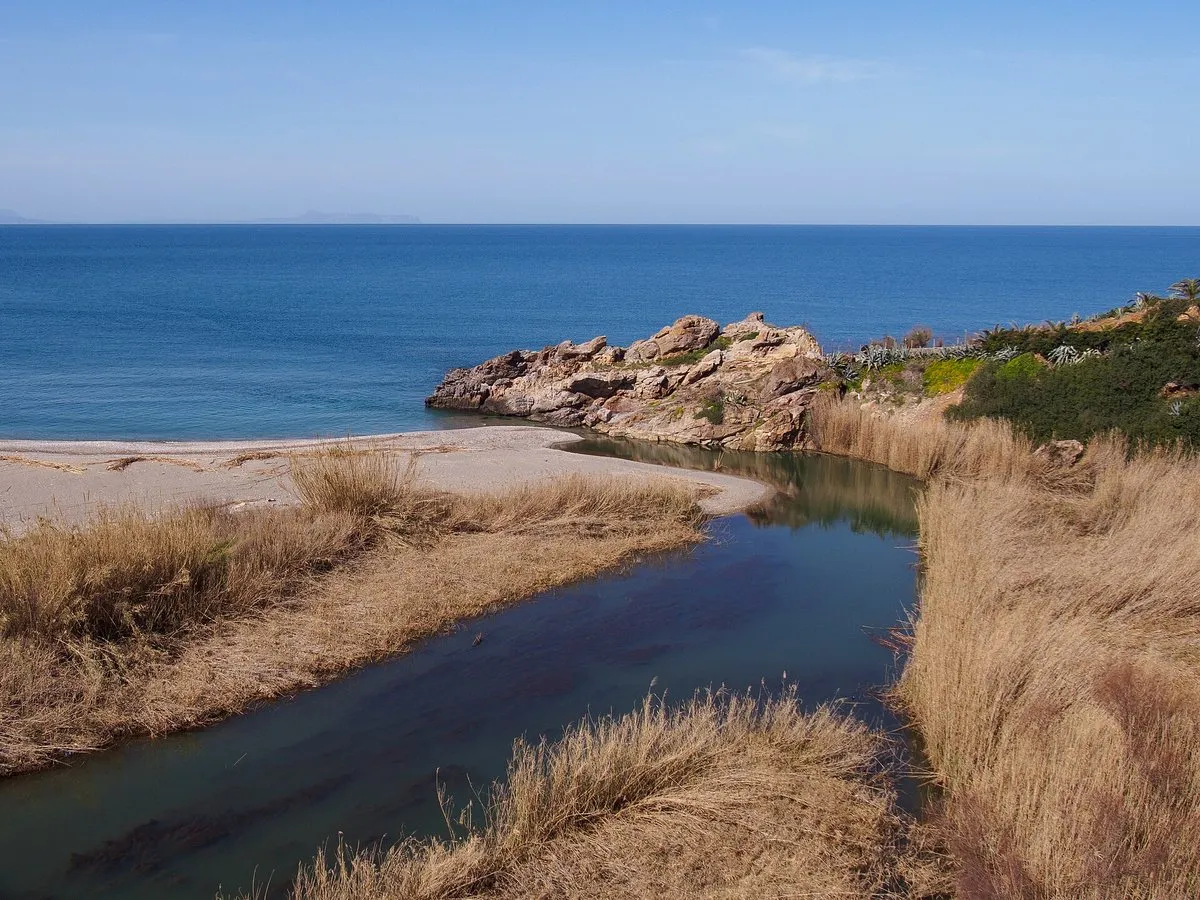
A beach with a river in it
What makes Geropotamos different from the long north-coast strands is the river. It flows even in summer, collects in a reed-fringed lagoon at the east end, and then cuts its channel across the sand. Swimming where fresh water meets salt is part of the appeal and part of the caution: the water is colder than the sea a hundred metres along. Families with small children will be happier in Panormo’s sheltered harbour cove; strong swimmers and anyone who likes a wild beach will prefer this one.
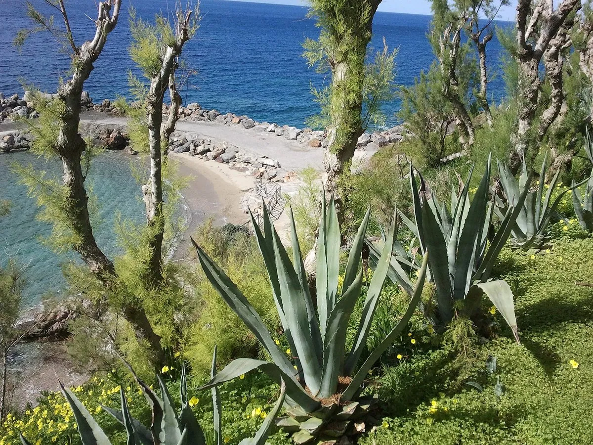
West of the beach, beach listings describe a rock arch known as Kamara with a tiny beach reachable only by boat; to the east, the low headland towards Panormo hides small coves cut into the rock. Neither changes the day much — Geropotamos is a single long beach, and that is its point.
Reading the wind
This is the part that decides the visit. The bay faces straight north, with nothing to break the summer meltemi, so on a typical July afternoon the waves build high enough to close the water. The pattern is predictable: calm or nearly calm early, rougher from late morning, easing towards evening. Come before eleven or after five, check the forecast the night before, and treat a red flag as final — how the flags work is not a formality here. On a genuinely windy day, Bali’s sheltered coves are fifteen minutes east and usually swimmable.
Making a day of it
Geropotamos pairs naturally with Panormo for lunch and a stroll around the harbour, and with an inland run to the Melidoni cave on the hottest hours of the day. From Rethymno it is a 20-minute drive; from Heraklion, a little under an hour on the highway.
The honest downside
No shade outside the small organised section, a dirt access road, noise from the highway bridge overhead, and a north-facing bay that turns rough on exactly the summer afternoons most people have free.
Worth it if: you like wild, open beaches, come early on a calm day, and can bring your own shade. Skip it if: you need shallow, sheltered water for small children, reliable facilities, or a beach that stays calm through a windy afternoon.
Photos on this page: the river mouth by C messier (CC BY-SA 4.0) and the cove by Daniel Șuteu (CC BY 3.0), via Wikimedia Commons, resized for the web. The beach is described from our own visits; distances, access and conditions were checked against published beach listings for the date shown at the top of this guide. Nobody pays to be featured in a guide — no business, no sponsor, no paid mention, ever. Adverts, where they appear, are labelled as adverts.
Where is Geropotamos beach?
On the north coast of Rethymno regional unit, about 18 km east of Rethymno town and 3 km west of Panormo, directly below the national road bridge over the Geropotamos river. Distances vary slightly between sources, from 17 to 19 km from Rethymno.
How do you get to Geropotamos beach?
By car, leave the national road at the bridge and take the short dirt road down to the parking area on the far side. KTEL coastal buses use the highway above; beach listings say drivers will stop if asked, but we could not find an official stop on the timetable, so do not rely on it for the return.
Is Geropotamos beach organised?
Only a small part. A short section has umbrellas and sunbeds with a canteen and toilets in season; most of the beach is free and wild, with no natural shade. Bring an umbrella if you plan to stay past mid-morning.
Is Geropotamos safe for swimming?
On calm days, yes, with care: the water deepens quickly and the river keeps it noticeably cold near the mouth. The beach faces north and is fully exposed to the meltemi, which raises big waves on summer afternoons — on those days, respect the flags and swim somewhere sheltered instead.
Is Geropotamos the same as Petres beach?
No. Petres is on the other side of Rethymno, about 13 km west of the town at the eastern end of the long Episkopi beachfront. Geropotamos is east of Rethymno, next to Panormo.
One email a month — only when something on this island actually changes. No spam, no partners, one-click unsubscribe. Read past issues before you decide.