Hiking in Crete: The Honest Guide to the E4 and the Best Day Walks
The E4 long-distance path from Kissamos to Kato Zakros, and the day walks that are worth building a holiday around — with real distances, the fire-risk closures, heat, hunting season and what to carry.
Crete is one of the great walking islands of Europe, and most visitors see none of it beyond a single gorge. The E4 long-distance path runs the length of the island, the White Mountains and Psiloritis carry real high-mountain routes, and there are day walks from easy gorges to exposed coastal paths. This guide gives the honest shape of it: distances and times from the Region of Crete’s official tourism site and walkers’ sources, and the rules that close paths in summer, checked in September 2026. The walks are described from our own; the figures come from those sources rather than from memory.
The honest facts
- The E4
- crosses Crete from Kastelli-Kissamos to Kato Zakros, with coastal and mountain variants. Published lengths vary widely; parts are overgrown or poorly marked.
- Waymarks
- yellow-and-black E4 plates and paint marks.
- Best seasons
- spring and autumn. Summer needs dawn starts and several litres of water each.
- Fire-risk closures
- on category 5 days the Region closes Samaria, Imbros, Aradena, Agia Irini and other gorges; some E4 sections close from category 4.
- Emergency
- 112 — free, works without a SIM.
- Hunting season
- runs 20 August 2026 to 28 February 2027 nationally — wear a bright layer off-path.
- Snakes
- the only venomous species, the cat snake, is harmless to people.
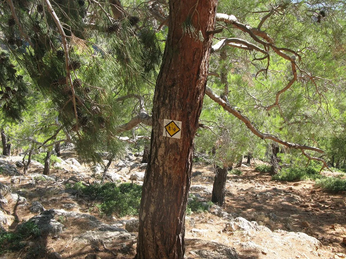
The E4, honestly
The E4 is a European route that runs from Spain to Cyprus, and its Cretan section is the wildest part of it. Here it follows the south coast for long stretches, crosses the White Mountains and Psiloritis on its mountain variants, and ends at Kato Zakros in the far east. Walking all of it takes around two to three weeks. The waymarking is good in places and absent in others, the European Ramblers’ Association itself flags stretches that are poorly marked, and water and accommodation between villages need planning. Most people walk sections: the south coast between Sougia, Agia Roumeli, Loutro and Chora Sfakion is the classic.
Eight day walks worth building a trip around
- Samaria Gorge — about 18 km and 5–8 hours from Xyloskalo to Agia Roumeli, ticketed, usually open May to October. The famous one, and a full day.
- Imbros Gorge — about 8 km, 2–3 hours downhill, rated very easy and open all year.
- Agia Irini Gorge — about 7.5 km, 3 hours, shaded, towards Sougia.
- Aradena Gorge — about 5.5 km and 2.5 hours to Marmara beach, including a 9-metre iron ladder; Loutro is about an hour further.
- Chora Sfakion to Loutro — about 7 km, 2 hours on a rocky coastal path with drops to the sea and little shade.
- Psiloritis from Nida — Crete’s highest summit, around 1,100 m of climbing and a full day. Summer only.
- Richtis Gorge — about 3 km to a waterfall and a beach in the east; the Region lists a €3 fee and a last-entry time.
- Zakros, the Gorge of the Dead — about 1.5 hours down from Epano Zakros to Kato Zakros and the Minoan palace.
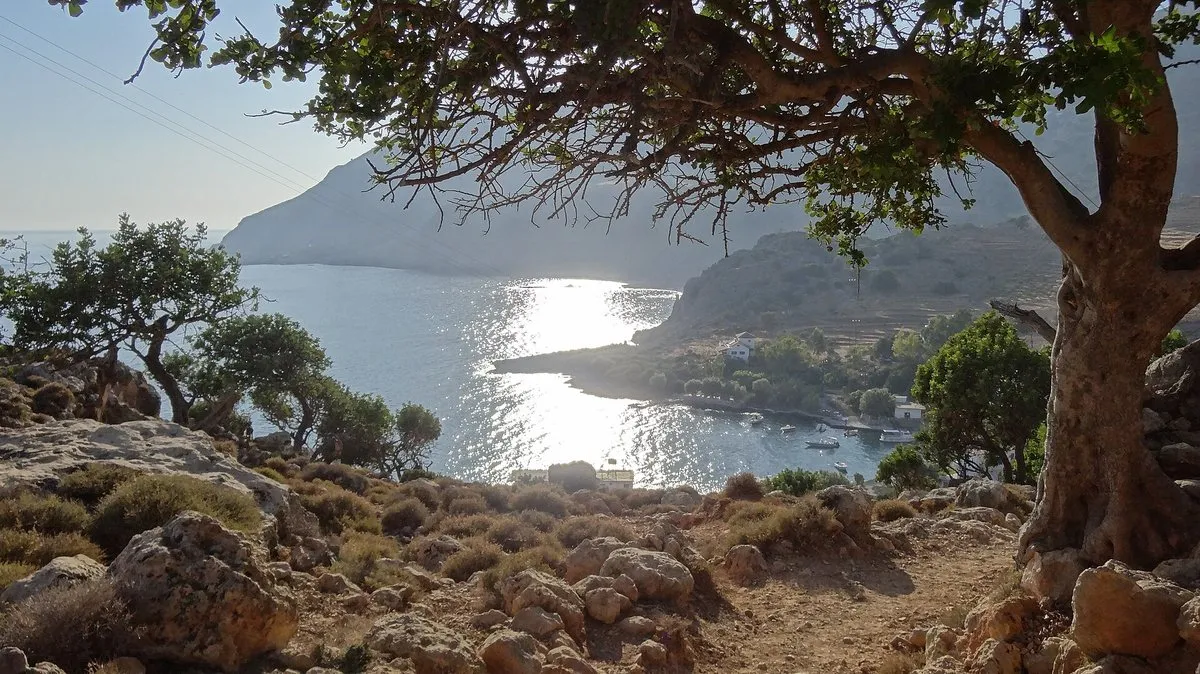
Heat, fire and the rules
Summer is the season when most visitors are in Crete and the worst one for walking. Shade is scarce above the gorges, temperatures on bare slopes climb past 30 °C, and many people underestimate water by half. From June the Region of Crete also publishes its fire-season order: on high fire-risk days listed forests, gorges and E4 sections are closed to everyone. Check the civil protection fire-risk map the evening before; our guide to the 112 alerts explains how it works.
What to carry and how to navigate
Proper boots, more water than you think, sun protection, a warm and windproof layer for anything above 1,500 metres, food and a charged phone. For navigation, Greek specialist publishers produce 1:25,000 hiking maps for the main mountain areas, and GPX tracks for the popular routes are easy to find — carry both, because signal fades in the gorges. Many one-way walks end far from where they started: plan the bus, boat or taxi back before setting off.
The honest downside
Crete’s walking infrastructure is uneven. Waymarks vanish, paths get overgrown, water points fail, and the famous gorges are crowded in season while the quiet ones need logistics. Summer — the season most people visit — is the wrong one for most of this, and the fire-risk closures can cancel a planned walk the evening before.
Worth it if: you can travel in spring or autumn and want to see the Crete that the beach resorts hide. Skip it if: you are here in August and the plan is a midday walk — do a gorge at dawn or save it for another trip.
Photos on this page: the E4 waymark by Lungo41 (CC BY-SA 4.0) and the bay of Phoinix by Rockhopper2 (CC BY-SA 3.0), via Wikimedia Commons, resized for the web. Distances and times come from the Region of Crete’s official tourism site, the European Ramblers’ Association, Chania’s and Heraklion’s mountaineering clubs and walkers’ sources, which do not always agree; closures from the Region’s 2026 fire-season order; emergency details from Greece’s civil protection 112 service; all checked for the date shown at the top of this guide. The walks are described from our own; distances, times and rules are a check of published sources. No guide company, map publisher or app is named or recommended. Nobody pays to be featured in a guide — no business, no sponsor, no paid mention, ever. Adverts, where they appear, are labelled as adverts.
-
The walks
1 Xyloskalo (Samaria entrance) 2 Agia Irini village (gorge entrance) 3 Aradena 4 Loutro 5 Imbros village 6 Nida Plateau (Ideon Cave car park) 7 Richtis Gorge 8 Kato Zakros
Tap a name to open it in your map app. These are options, not an order — pick by the day you have.
Where does the E4 path run in Crete?
The E4 European long-distance path crosses Crete from Kastelli-Kissamos in the west to Kato Zakros in the east, with coastal and mountain variants in places. It is waymarked with yellow-and-black E4 signs and paint marks; published lengths for the Cretan section vary widely, and some stretches are overgrown or poorly marked.
What is the best time of year for hiking in Crete?
Spring and autumn are the most comfortable. Summer walking is possible with very early starts and plenty of water, but July and August heat on shadeless slopes is dangerous, and on high fire-risk days many forests, gorges and E4 sections are closed by the Region of Crete.
Which is the easiest gorge walk in Crete?
The Imbros Gorge, about 8 km and two to three hours downhill, is rated very easy by the Region of Crete and is open all year. The Agia Irini Gorge, about 7.5 km and three hours, is the shaded alternative in the west.
Are gorges in Crete closed on fire-risk days?
Yes. The Region of Crete's 2026 order closes Samaria, Imbros, Aradena, Agia Irini and other gorges on category 5 fire-risk days, and some E4 sections, such as those out of Sougia, from category 4. Check the civil protection fire-risk map the evening before.
Are there dangerous snakes in Crete?
No. The cat snake is the only venomous snake on Crete, and its venom is too weak to harm people. Heat, dehydration, falls and getting lost are the real hiking risks.
What number do you call for a hiking emergency in Crete?
112. It is free, works without a SIM card or from a locked phone, answers in Greek, English and French, and newer phones send their location automatically.
One email a month — only when something on this island actually changes. No spam, no partners, one-click unsubscribe. Read past issues before you decide.