Karoumes Beach and the Chochlakies Gorge: The Honest Guide to the Far East's Walk-In Beach
A pebble bay on Crete's far-east coast that no road reaches — about an hour and ten minutes down an easy gorge from the hamlet of Chochlakies, or a longer coastal E4 walk from Kato Zakros past the great Pelekita cave. Nothing to buy at the bottom, and that is the point.
Karoumes is the beach you walk to, and the walk is the easy part. No road reaches this pebble bay north of Kato Zakros: the Chochlakies gorge delivers you to it in a little over an hour from a hamlet on the Palekastro–Zakros road, and the coastal E4 from Kato Zakros, past the Pelekita cave, is the long way in. At the end there is clear water, pebbles and nothing else — no taverna, no sunbeds, no water — which is both the reward and the catch. Described from our own visits; distances, prices, hours and rules are a check of published sources, October 2026.
The honest facts
- Where
- a pebble bay at the mouth of the Chochlakies gorge, north of Kato Zakros; no road reaches it.
- From Chochlakies
- 3.5 km, about 1 hour 10 minutes one way on the Sitia Geopark’s gorge route (other listings say up to 1.5 hours); most walkers return the same way.
- From Kato Zakros
- the coastal E4 past the Pelekita cave — 7.9 km, about 2 hours 40 minutes on the Geopark’s route sheet; other published counts give 5.5–6 km.
- Pelekita cave
- about 100 m above the sea, roughly 310 m deep, with Neolithic finds.
- Facilities
- none. Carry water, food and shade, including for the walk back.
- Fire-season order
- none of these routes is named in the Region of Crete’s 16 June 2026 order.
- After heavy rain
- regional walking sources describe the gorge as impassable.
The gorge from Chochlakies
Chochlakies is a hamlet on the road from Palekastro to Zakros, and signs in the village point to the gorge. The Geopark gives a highest point of 137 m; regional walking sources call it small and easily accessible, with only about 50 m between entrance and outlet. The stream runs for much of the winter and leaves pools in spring; by summer the bed is usually dry, and the vegetation is sparse. Most people walk back the same way, so count about two and a half hours on foot in all, plus the swim.
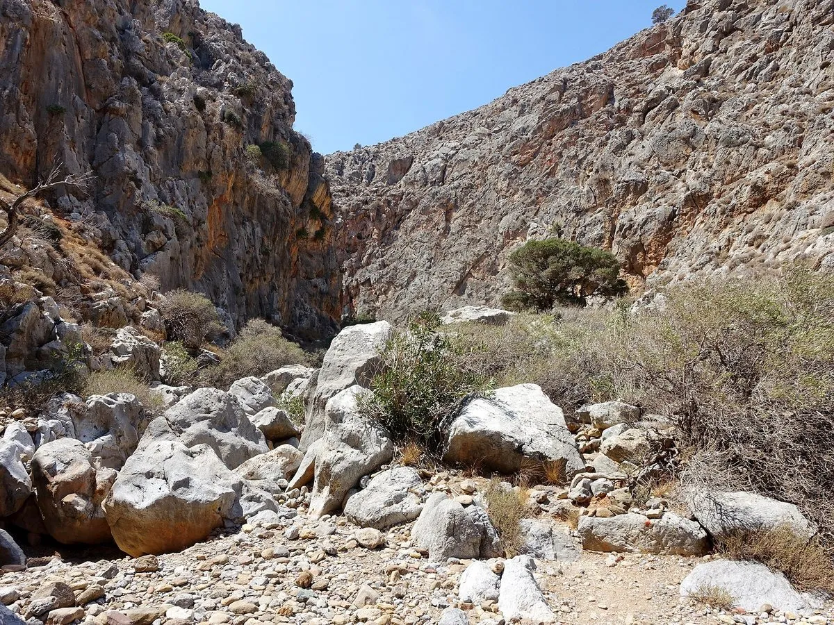
Karoumes beach
The gorge opens into a small valley, a marsh in winter by regional accounts, and then onto the beach: fine pebbles, clear water and limestone on both sides. The bay faces east and is usually calm, according to regional beach listings, with two tiny coves a few hundred metres to the south. Accounts of the shade disagree — one listing mentions only a few tamarisks — so bring your own. There is nothing to buy.
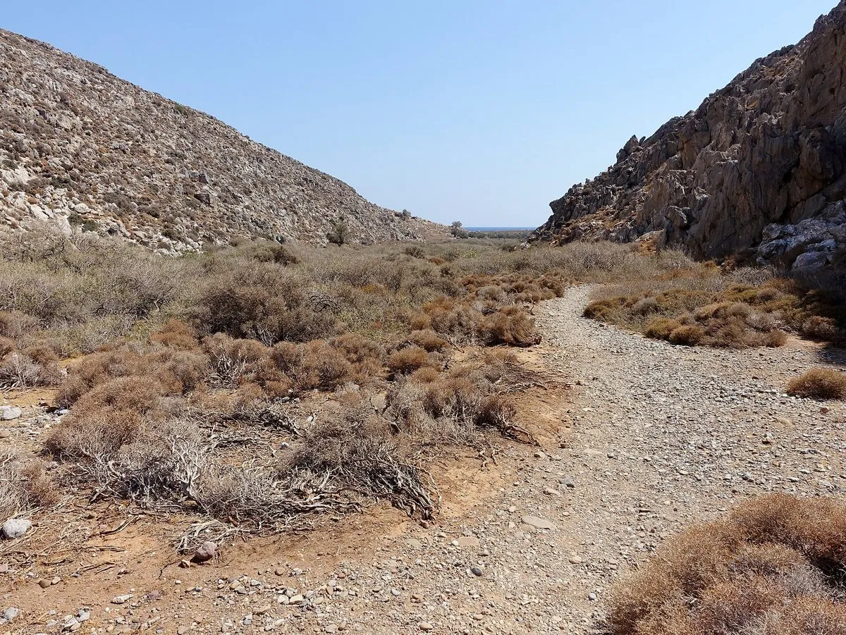
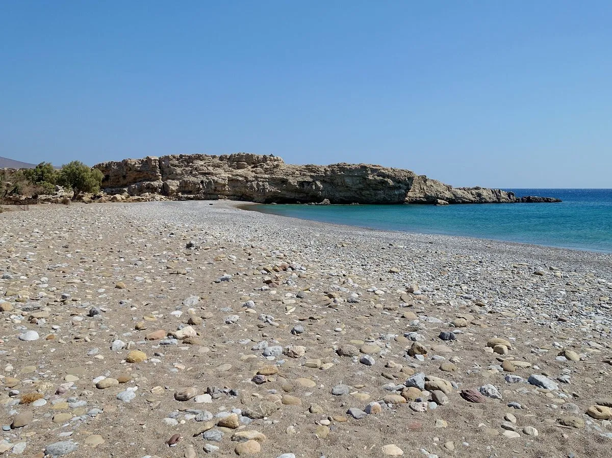
The coast path and the Pelekita cave
The other way in starts at Kato Zakros and follows the coast north on the E4, an old but clear trail in the Geopark’s words; walking sources warn that beyond the cave it becomes hard to follow and has little shade.
The Pelekita cave, about an hour from Kato Zakros, is one of the largest in the Sitia area: roughly 310 m deep by most counts, with water all year at the back. A database of Neolithic sites kept by the Austrian Academy of Sciences records pottery and obsidian from it. The entrance chamber is for a casual visit; deeper in, sources describe slippery boulders and steep slopes, which is caving with a torch, not a stroll. Near the cave is the ancient quarry that, regional sources say, supplied stone for the Zakros palace. The full line, Chochlakies to Kato Zakros by way of Karoumes, is about 11 km on the Geopark’s figures and needs a car at each end or a taxi.
Fire season, heat and rain
None of these routes is named in the Region of Crete’s fire-season order of 16 June 2026, which closes listed gorges, forests and E4 sections on category 4 and 5 days; its only entry in the Municipality of Sitia is Vai. The fire season runs to 31 October; on orange and red days, check the fire-risk map and 112 alerts anyway. Heat is the everyday risk, so start early, and after heavy rain the gorge is impassable, regional sources say.
Fitting it into a stay
Karoumes is a far-east day. From Sitia or Palekastro the walk and a swim fill a morning; three days in Sitia shows how the rest of this corner fits around it, and Xerokampos is the beach for a day without walking. Both routes are part of the E4 — see hiking in Crete — and lie inside the Sitia UNESCO Global Geopark, designated in 2015.
The honest downside
Everything is carried in and out: no road, no shop, no water and no reliable shade at the end. The gorge round trip is about two and a half hours of walking for a swim, with the uphill half last; the coast path is remote, faint beyond the cave and needs transport at the far end; and heavy rain can shut the gorge. On a still August afternoon it is hard work for a pebble beach.
Worth it if: you are staying in the far east, can walk two or three hours with water, food and shade on your back, and want a beach that no road reaches. Skip it if: it is a midsummer midday, heavy rain has just fallen, you need a taverna and a sunbed, or you are based west of Agios Nikolaos and the drive alone would be the day.
Photos on this page: all three by Olaf Tausch (CC BY 3.0), via Wikimedia Commons, resized for the web. Described from our own visits; distances, access, rules and any figures were checked against the Sitia UNESCO Global Geopark’s route and geosite pages, UNESCO, the Region of Crete’s fire-season order of 16 June 2026, the Austrian Academy of Sciences’ database of early farming sites and regional walking and beach listings, which disagree on some distances, for the date shown at the top of this guide. Nobody pays to be featured in a guide — no business, no sponsor, no paid mention, ever. Adverts, where they appear, are labelled as adverts.
-
The beach and the walks
1 Chochlakies village 2 Karoumes beach 3 Pelekita cave 4 Kato Zakros
Tap a name to open it in your map app. These are options, not an order — pick by the day you have.
Can you drive to Karoumes beach?
No. Karoumes beach is reached only on foot: no road runs down to it, and regional beach listings say plainly that you cannot reach it by car. The usual way is the Chochlakies gorge from the hamlet of the same name, about 3.5 km; the longer alternative is the coastal E4 path from Kato Zakros.
How long is the walk through the Chochlakies gorge to Karoumes?
The Sitia UNESCO Global Geopark gives the Chochlakies gorge route as 3.5 km and about 1 hour 10 minutes one way, with a highest point of 137 m. Regional walking sources call it small and easily accessible, with a height difference of around 50 m. Most walkers return the same way, so allow about two and a half hours of walking plus time on the beach.
Are there any facilities at Karoumes beach?
Karoumes beach has no taverna, no sunbeds, no toilets and no drinking water, according to the listings checked in October 2026. Bring food, more water than you think you need, including for the walk back, and sun protection. Published descriptions of the shade on the beach disagree, so do not count on it.
What is the Pelekita cave near Kato Zakros?
The Pelekita cave is a large cave about 100 m above the sea on the E4 coast path, roughly an hour's walk north of Kato Zakros. Regional sources describe it as about 310 m deep with water all year at the back, and an academic database of Neolithic sites records pottery and obsidian from it. Near it is an ancient quarry that supplied stone for the Minoan palace of Zakros.
Is the Chochlakies gorge closed on high fire-risk days?
The Chochlakies gorge, Karoumes beach and the coast path to Kato Zakros are not named in the Region of Crete's fire-season order of 16 June 2026, which closes listed areas on category 4 and 5 days during the fire season. On those days, check the daily fire-risk map and ask locally before setting off.
One email a month — only when something on this island actually changes. No spam, no partners, one-click unsubscribe. Read past issues before you decide.