The Kamares Cave: The Honest Guide to the Climb Above Kamares on Psiloritis
A steep three-to-four-hour climb from the village of Kamares to the cave on the southern side of Psiloritis that gave its name to Minoan Kamares ware — what the walk involves, why the cave matters, and why nobody agrees on how high it is.
The Kamares cave is a serious walk to an important hole in a mountain. From the village of Kamares on the southern side of Psiloritis, a waymarked path climbs for three to four hours to the cave that gave its name to Kamares ware, the thin, painted pottery of the first Minoan palaces. It is reached only on foot. It suits fit walkers on a clear, cool day in spring or autumn; it does not suit a hot afternoon, or anyone hoping for a show cave. Described from our own visits; distances, prices, hours and rules are a check of published sources, October 2026.
The honest facts
- Start
- Kamares village, on the southern side of Psiloritis, at about 600 m by one E4 route description.
- The cave
- north-north-east of the village, below the peak of Mavri; its altitude is disputed — 1,530 m by the Region of Crete, 1,700 m or 1,780 m in regional guides.
- Time
- about 3–4 hours up by the Region of Crete, which calls the climb difficult; down the same path.
- The path
- steep, described as well marked, partly through kermes-oak woodland, with several springs.
- Inside
- about 40 m long, ending in a small chamber with stalactites, per the Region.
- Why it matters
- the name-site of Kamares ware; the finds are in Heraklion, not in the cave.
- Fire-season order
- the cave and Psiloritis are not named; Rouva–Zarou, east of Kamares, is.
The climb from Kamares
Kamares sits on the southern foothills of Psiloritis, west of Zaros; the E4 walking stage between the two villages heads east for 13 km. From the village the path to the cave climbs steeply through the Kamares forest, with small stands of kermes oak, and walking guides describe it as well marked, with several springs and wide views over the Messara plain. The Region of Crete gives three to four hours up and calls it difficult; one regional guide gives about 3.5 hours. You come back down the same way, so allow most of a day.
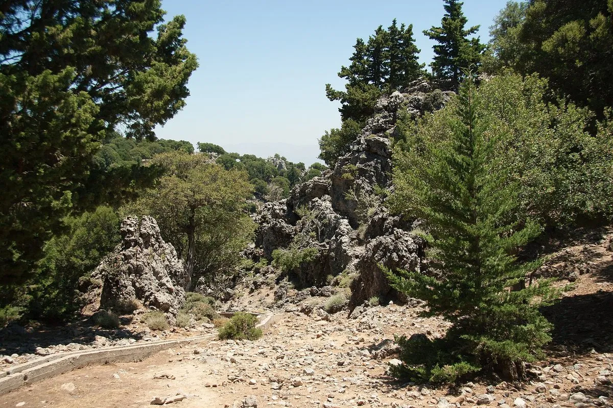
Strong walkers also reach the cave from the Nida plateau over the high mountain, linking to the E4. That is a different undertaking; the Psiloritis guide explains what the open ground up there demands.
Why the cave matters
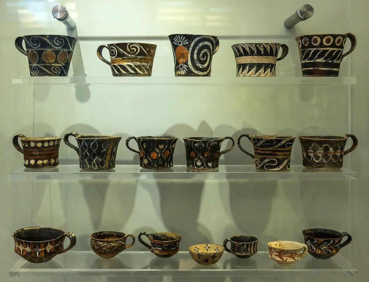
The Region describes a cave about 40 m long that leads into a small chamber with stalactites and stalagmites, and one regional guide says that as a cave it is unremarkable. Its importance is archaeological. Pottery found here, very thin-walled “eggshell” vessels with colourful decoration, gave its name to Kamares ware, the style also found at the palaces of Knossos and Phaistos and elsewhere on the Messara. Regional guides date the cave’s pottery to roughly 2000–1700 BC, and one suggests that people from Phaistos used the cave for offerings; the Region adds that warriors left spearheads here in the Late Minoan period and the early Iron Age.
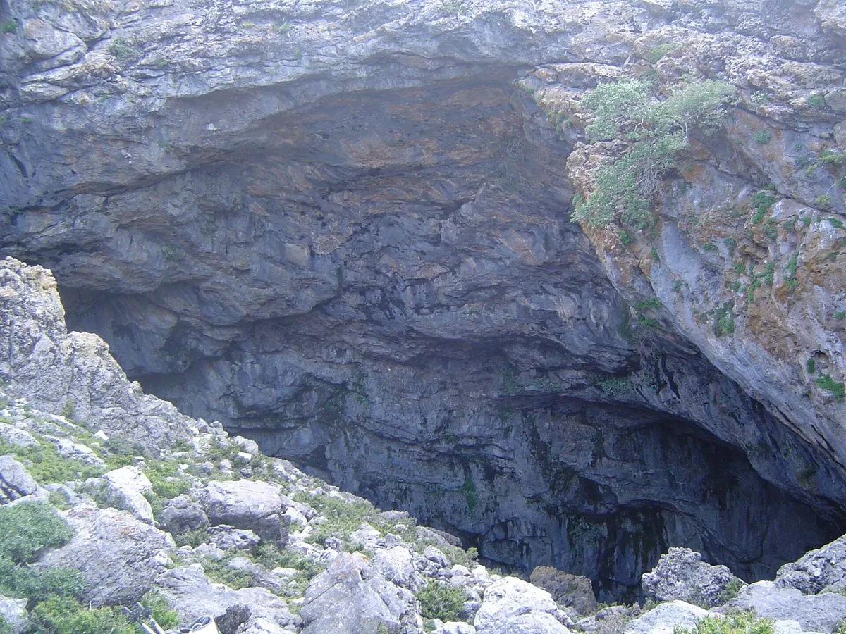
The pottery is not in the cave now: regional guides say it is displayed in Heraklion, so see it in the archaeological museum before or after the climb, and the cave becomes a place rather than a hole.
Rules, snow and heat
No official source opened for this guide lists a fee, opening hours or a permit for the cave, and the Region notes that it has many visitors in summer. It is an archaeological site all the same: touch nothing, take nothing, and leave any sherd where it lies.
The weather sets the real rules. The cave sits about as high as the Nida plateau or higher, and Nida snows in after winter cold spells, so in winter and early spring the upper path can be under snow. In July and August the lower slopes are hot, and the climb belongs to first light. Spring and autumn are the seasons to aim for, with a forecast that promises a clear top.
Fire season and the day around it
The Region of Crete’s fire-season order of 16 June 2026 does not name Psiloritis or the Kamares cave. The nearest listed area on this side of the mountain is Rouva–Zarou, east of Kamares in the municipalities of Gortyna and Phaistos, closed to people and vehicles on category 4 and 5 days; the Rouvas gorge guide covers it. A day of category 4 heat and wind is a bad day for a long climb anyway, so read the fire-risk map the evening before. It is a summer rule: the fire season formally ends on 31 October.
For an easier day on the same mountainside, Zaros and its lake lie to the east, and Phaistos, where Kamares-style vessels were also found, is down on the Messara plain.
The honest downside
It is a long, steep climb to a cave with little to see inside, and the pottery that made it famous is in a museum in Heraklion. Its altitude is not even agreed. The descent is on the same path, the springs are not something to rely on, and the season is narrow: snow at one end of the year, heat at the other.
Worth it if: you are a fit walker who cares about the Minoans, you have a clear spring or autumn day, and you have seen the Kamares ware in Heraklion first. Skip it if: you want a cave to look at rather than a place to stand in, it is a hot summer afternoon, or the upper mountain still has snow.
Photos on this page: the path by Zde (CC BY-SA 4.0), the cave mouth by Pascal Mullon (CC BY-SA 4.0) and the Kamares-ware cups by Jebulon (CC0), via Wikimedia Commons, resized for the web. Described from our own visits; distances, access, rules and any figures were checked against the Region of Crete’s tourism site and its 2026 fire-season order, published E4 route descriptions and regional walking guides, which disagree on the cave’s altitude, for the date shown at the top of this guide. Nobody pays to be featured in a guide — no business, no sponsor, no paid mention, ever. Adverts, where they appear, are labelled as adverts.
-
The climb 23 min driving · 9.8 km
1 Kamares village → 23 min → 2 Kamares cave
Driving times are Google's own, without traffic, checked November 2026 — the shape of the day, not a promise. Allow more on mountain roads, and more again in August.
How long is the hike to the Kamares cave?
The climb from Kamares village to the Kamares cave takes about three to four hours up, according to the Region of Crete, which calls it difficult; one regional walking guide gives about 3.5 hours. The way back is down the same path. Allow most of a day for the round trip.
How high is the Kamares cave?
Published altitudes for the Kamares cave disagree: the Region of Crete gives 1,530 m, one regional guide 1,700 m and another 1,780 m. An E4 route description puts Kamares village at about 600 m, so the climb is somewhere between roughly 900 and 1,200 m of ascent. On any of those figures it is a long, steep walk.
What is Kamares ware?
Kamares ware is Minoan pottery named after the Kamares cave, where it was found: very thin-walled vessels, described as eggshell ware, with colourful decoration. The same style was found at the palaces of Knossos and Phaistos. Regional guides say the cave's pottery is displayed in the Heraklion Archaeological Museum.
Is there water on the way to the Kamares cave?
Walking guides describe several springs on the path from Kamares to the cave, which climbs partly through kermes-oak woodland. No source guarantees how much they run late in a dry summer. Carry all the water you need for a steep climb of several hours.
Is the Kamares cave path closed on high fire-risk days?
Neither Psiloritis nor the Kamares cave is named in the Region of Crete's fire-season order of 16 June 2026. The nearest listed area on the same side of the mountain is Rouva–Zarou, east of Kamares, which closes to people and vehicles on category 4 and 5 days. On those days check the national fire-risk map and ask locally before setting out.
One email a month — only when something on this island actually changes. No spam, no partners, one-click unsubscribe. Read past issues before you decide.