The Asterousia: An Honest Guide to Crete's Wild Southern Wall
The driving-and-walking overview of the island's least-known range — the villages, the vulture skies, the dirt-road truth.
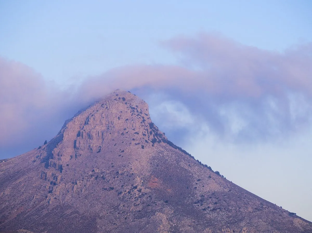
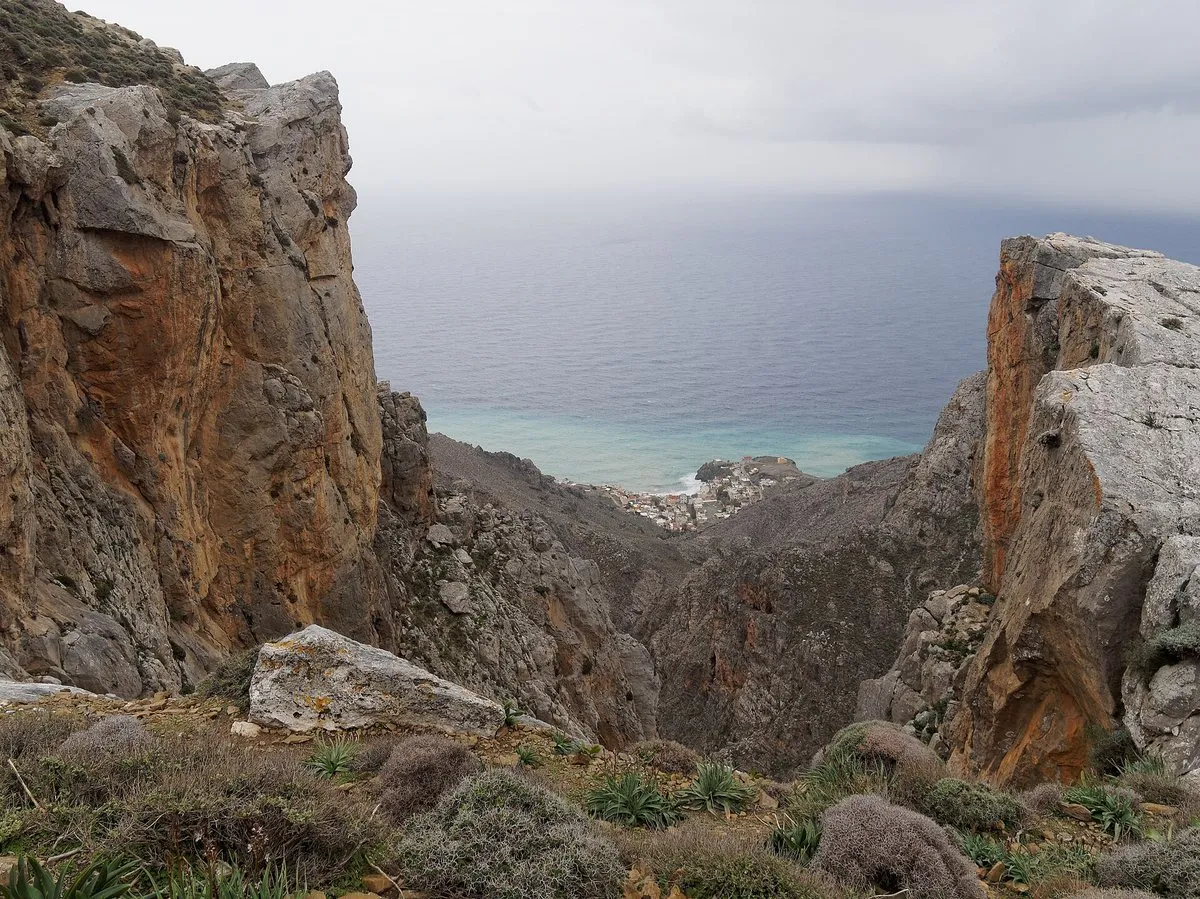
The Asterousia are the mountains most visitors never learn the name of: the arid wall between the Messara plain and the Libyan Sea, too low for ski-glamour, too harsh for coach tours, and precisely wild enough to host griffon vulture colonies, hermit caves, and hamlets that greet strangers because they see so few. UNESCO lists the range as a Biosphere Reserve; Cretans list it as where you go to disappear well.
The honest facts
- Orientation
- the range runs east–west south of Mires and Pyrgos; paved spines reach Kapetaniana, Ethia, Achendrias and the coastal drops (Lentas, Tris Ekklisies, Tsoutsouros); dirt takes over toward Koudoumas, Maridaki, Agios Ioannis.
- The car truth
- paved routes suit any car; the famous dirt descents want dry weather, patience and acceptance that 15km can take 40 minutes. Fuel tanks leave the Messara full.
- The sky
- griffon vultures are near-guaranteed on thermals over the ridges — one of Europe’s densest populations; Bonelli’s eagles for the lucky.
- Walking
- Kofinas summit (30–45 min from the saddle) is the accessible classic; gorge routes (Agiofarago, Trafoulas, Maridaki) reward proper walkers; the E4 threads it all.
- Season note
- spring turns the “arid” slopes briefly, absurdly floral; high summer afternoons are anvil-hot — mornings rule.
Building the day
The proven loop from the north coast: Pyrgos coffee → Kapetaniana and the Kofinas walk → lunch at altitude → EITHER the Koudoumas dirt pilgrimage OR the paved drop to Tris Ekklisies/Lentas for the swim → sunset drive across the Messara. Two days with a Kapetaniana or Lentas overnight converts a sampler into an experience.
Without a car the range is hard going. KTEL Heraklion–Lasithi’s current timetable lists Lentas on its line through Mires, but none of the inland villages appeared among its listed destinations; check the timetable before planning around it, and see the Crete bus guide for how the network works.
The villages
Ethia’s near-abandonment, Achendrias’ working stubbornness, Paranymfi’s balcony position — these are places to buy a coffee, greet the kafeneio, and understand what depopulation and endurance look like at eye level. Photograph landscapes freely; people, only after the greeting.
What the reserve protects
The Asterousia joined UNESCO’s World Network of Biosphere Reserves in 2020. The designated area reaches well beyond the mountains: roughly 125,700 hectares, about 88,600 of them sea. UNESCO calls it the southernmost mountainous area of Europe, topped by Kofinas at 1,231 m, and credits it with over half of the island’s animal and plant species. The regional UNESCO portal counts 192 bird species and some thirty endemic plants; over the peaks, UNESCO lists bearded vultures, griffon vultures, golden eagles and Bonelli’s eagles. Lower down, Cretan date palms grow in a few sheltered spots, Agios Nikitas and Martsalo among them. People have lived here since the Neolithic, and prehistoric dwellings dated to about 3200–2000 BC survive on the mountain, the slopes and the coast.
Monasteries, gorges and climbing
Hermits and monks shaped this coast as much as shepherds did. The sites named on the regional UNESCO portal include the monastery of Panagia Odigitria, Agios Antonios at Apezanes, Agios Nikitas near Achendrias, and Agiofarago with its hermit caves and gorge-mouth beach; Koudoumas sits at the end of its own long dirt descent. Treat them as places of worship, and check access locally before driving out.
The same portal lists more than 60 paths, 14 of them designed routes that mostly start mid-mountain and end on the south coast; the best known, named after Kofinas, runs past Agiofarago, Agios Nikitas, Tris Ekklisies and Koudoumas. Of the twenty-plus gorges, Maridaki, Martsalo, Agiofarago, Trafoulas and Agios Savvas are described as walkable. Others, Ambas among them, are technical canyoning terrain for equipped, experienced groups only; the Ambas waterfall is given as roughly 140–145 m, the island’s highest. Climbers have about 180 routes around Kapetaniana alone, but the portal advises against climbing from December to February, when birds of prey breed. Cycling is suggested from April to mid-November.
The honest downside
Distances stretch, services vanish, and the range’s beauty is austere — lovers of green alpine drama may read it as emptiness. It is emptiness; that is the offer.
Worth your time if: you want the Crete that tourism forgot to schedule. Skip it if: the day’s success requires certainty — the Asterousia deal in weather, dust and luck.
Photos on this page: both by C messier (CC BY-SA 4.0), via Wikimedia Commons, resized for the web. Everything above was checked for the date shown at the top of this guide. Sections added in October 2026 were checked against published sources rather than on a new visit. Nobody pays to be featured in a guide — no business, no sponsor, no paid mention, ever. Adverts, where they appear, are labelled as adverts.
-
The day — Coffee low, summit early, swim on the far side 1h35 driving · 56.9 km
1 Pyrgos → 37 min → 2 Kapetaniana → 58 min → 3 Tris Ekklisies
Driving times are Google's own, without traffic, checked November 2026 — the shape of the day, not a promise. Allow more on mountain roads, and more again in August.
Do you need a 4x4 for the Asterousia?
Not for the paved spines, which reach Kapetaniana, Ethia, Achendrias and the coastal drops and suit any car. The famous dirt descents toward Koudoumas, Maridaki and Agios Ioannis want dry weather, patience, and acceptance that 15km can take 40 minutes.
Can you see vultures in the Asterousia?
Griffon vultures are near-guaranteed on the thermals over the ridges - this holds one of Europes densest populations. Bonellis eagles turn up for the lucky. Mornings and the ridge roads are where to look.
What is the Kofinas walk like?
Thirty to forty-five minutes from the saddle to the summit, and the accessible classic of the range. Longer gorge routes at Agiofarago, Trafoulas and Maridaki reward proper walkers, and the E4 threads the whole range.
When is the best time to visit the Asterousia?
Spring, when the arid slopes turn briefly and absurdly floral. High summer afternoons are anvil-hot and mornings rule. Fill the tank before leaving the Messara - services vanish once you are in the range.
Is the Asterousia worth a day?
If you want the Crete that tourism forgot to schedule, yes. The proven loop is coffee at Pyrgos, Kapetaniana and the Kofinas walk, lunch at altitude, then either the Koudoumas dirt pilgrimage or the paved drop to the coast for a swim. Two days with an overnight converts it from drive to immersion.
Can you reach the Asterousia by bus?
Only partly. KTEL Heraklion–Lasithi's current timetable lists Lentas on its line through Mires, but inland villages such as Kapetaniana did not appear among its listed destinations. For the mountain roads, the monasteries and the Kofinas walk, a car is the practical option; check the current timetable before relying on any bus.
One email a month — only when something on this island actually changes. No spam, no partners, one-click unsubscribe. Read past issues before you decide.