Fournes, Meskla and the Keritis Valley: The Honest Guide to Chania's Orange Valley
The valley of the Keritis river runs from its springs at Meskla, under the White Mountains, past the orange groves of Fournes and Alikianos towards Lake Agia. Above it sit Zourva and, on the Omalos road, Lakki. Birds, oranges, old churches, a short gorge loop and a hard 1941 history, most of it within 21 km of Chania.
The Keritis valley is Chania’s back garden: a plain of orange groves running south-west from the city towards the White Mountains, with the river’s springs at its head. It has no single big sight, just a string of small ones, most within 21 km of town — Lake Agia and its birds nearer town, Alikianos and its 1941 memory, the orange village of Fournes, Meskla with its springs and old churches, and above them Zourva and Lakki. Treat it as a half-day drive, not a destination. Described from our own visits; distances, prices, hours and rules are a check of published sources, October 2026.
The honest facts
- Where
- the valley of the Keritis river, south-west of Chania; Fournes is 15 km from the city and Meskla 21 km, by the Municipality of Platanias.
- Lake Agia
- an artificial lake about 9 km from Chania, with more than 200 bird species recorded.
- The oranges
- the municipality calls these the orange villages; Fournes holds a citrus-blossom festival every May.
- Meskla
- the springs of the Keritis at its southern edge, two old churches and a short loop gorge.
- Above the valley
- Zourva, 6–7 km uphill from the Meskla springs; Lakki, on the Omalos road at about 550 m.
- Fire order
- no village or walk in the valley is named in the 2026 order.
Lake Agia, nearer town
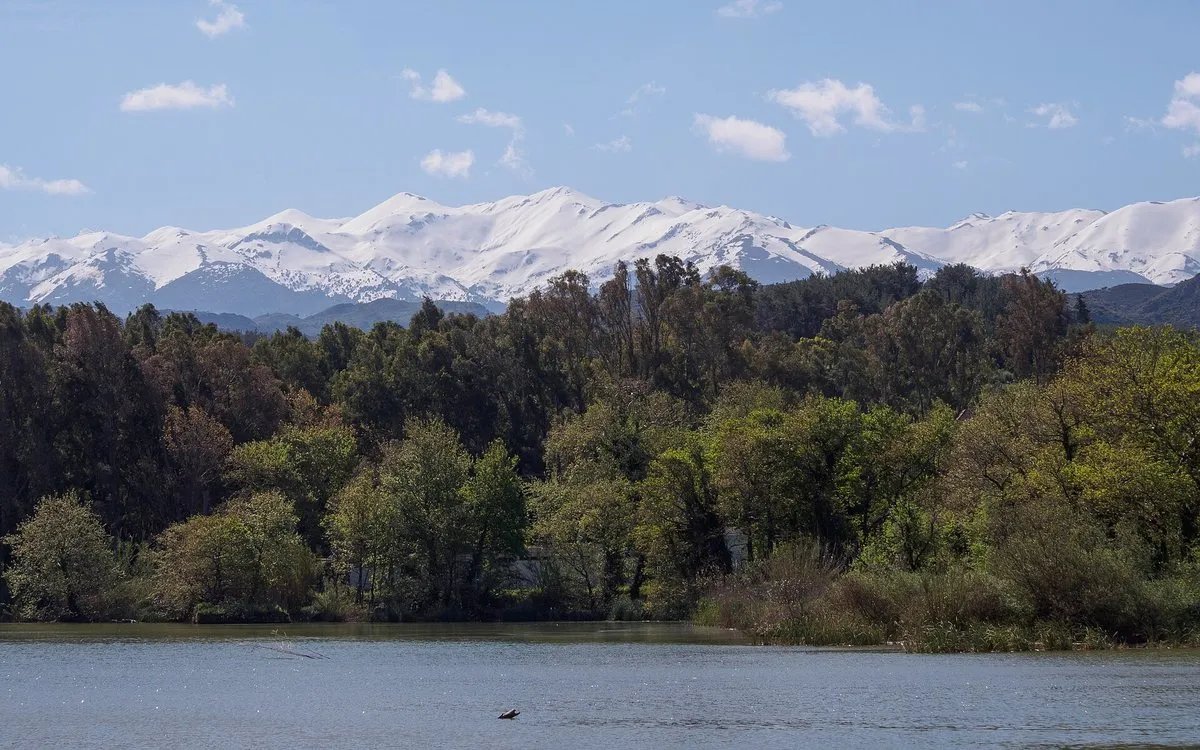
The Region of Crete says Lake Agia, south-west of Chania, is artificial but has perhaps the richest variety of wetland plant communities on the island. Regional sources describe a marsh turned into a reservoir for a hydroelectric station that no longer works, fed by springs and a stream from the White Mountains. Birdwatching sources count more than 200 species recorded there, with spring and autumn the best seasons for migrants.
Alikianos and Fournes: the orange plain
Alikianos, 12 km from Chania, sits in the middle of the fertile Keritis valley; the municipality identifies the river with Homer’s Iardanos. Its three-arched stone bridge over the Keritis, built in 1908, collapsed in the floods of February 2019, and the municipality links the spot to the execution of residents of Alikianos and nearby villages by the German occupiers in 1941 — 108 or 118 people, depending on the source. Alikianos is the centre of the Battle of Crete anniversary every 21 May; our Battle of Crete guide covers the wider campaign.
Two kilometres on, the road through Fournes runs between orange trees heavy with fruit, and each May the village holds the festival of the anthonero, the citrus-blossom water.
Meskla: the springs and the churches
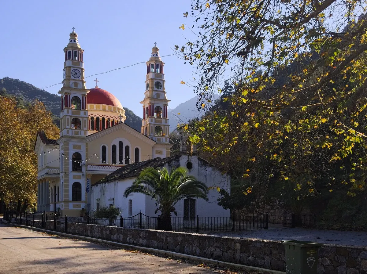
Meskla, about 4 km beyond Fournes and 21 km from Chania, ends in the Pigés, the springs of the Keritis, at its southern edge. The municipality lists a church of the Virgin and an older church of Christ. An unofficial regional website dates the church of Christ the Saviour to the first half of the 13th century, with wall paintings in at least three layers, one dated by inscription to 1303, and puts the old church of the Virgin over a fifth-century basilica with mosaic floors. Neither publishes opening hours. A short gorge, also called Sarakina, makes a loop of a little over an hour from the village, on steps and walkways under cypress and plane, by a regional walking guide’s account.
Zourva and Lakki: above the valley
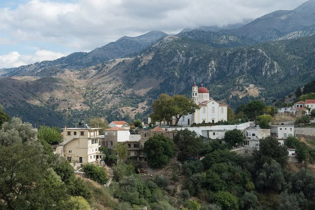
Zourva clings to the mountain tops 6–7 km uphill from the Meskla springs; the municipality notes that its road runs 8–10 km east to Theriso, in the next valley, and 14 km on to Chania, and lists marked trails, a cave called Vrysi and the Tromarissa viewpoint. Lakki stands on the road from Chania to the Omalos plateau, spread over the slopes of four hills. The municipality calls its history rich in revolutions; a monument in the square shows three Cretan fighters, and its church of Agios Georgios dates from the 12th century and celebrates on 3 November.
Omalos is about 15 km further on, at 1,050 m by the municipality’s figure, and the road continues to the top of the Samaria gorge, which NECCA’s ticket site says remains closed from both entrances until further notice. The Region of Crete’s fire-season order names nothing in this valley, though it closes Samaria and the road to the Kallergi mountain refuge on category 5 days in summer.
Doing it in a half-day
Sleep in town — see where to stay in Chania — and the valley is a morning out of Chania old town: Lake Agia early for the birds, Alikianos and Fournes on the way up, Meskla’s springs and the gorge loop, then lunch in Zourva or Lakki; the municipality says Zourva draws visitors for its views, food and trails.
The honest downside
The Keritis valley is small things spread along two roads: a lake you walk round, churches with no published hours, a short gorge, two villages higher up. It is a trip for a car. The river can turn violent after long rain — the Alikianos bridge fell in 2019 — and the big walk from Omalos, Samaria, is closed until further notice.
Worth it if: you are staying around Chania and want a half-day inland — birds at Lake Agia, orange groves, the springs at Meskla, a short gorge and a mountain lunch. Skip it if: you want one headline sight rather than several small ones, or you were planning to walk Samaria from Omalos while it remains closed.
Photos on this page: Lake Agia and the Meskla churches by C messier (CC BY-SA 4.0) and Lakki by Alexey Komarov (CC BY-SA 4.0), via Wikimedia Commons, resized for the web. Described from our own visits; distances, access, rules and any figures were checked against the Municipality of Platanias, the Region of Crete’s ecotourism pages and its 16 June 2026 fire-season order, NECCA’s Samaria ticket site, and regional, birdwatching and reference sources for the date shown at the top of this guide. Nobody pays to be featured in a guide — no business, no sponsor, no paid mention, ever. Adverts, where they appear, are labelled as adverts.
Tap a name to open it in your map app. These are options, not an order — pick by the day you have.
Where is the Keritis valley in Crete?
The Keritis valley lies south-west of Chania, running from the springs of the Keritis river at Meskla, at the foot of the White Mountains, down past Fournes and Alikianos. By the Municipality of Platanias's figures Fournes is 15 km and Meskla 21 km from Chania, which makes the valley an easy half-day from the city by car.
Is Lake Agia worth visiting?
Lake Agia is worth an hour for anyone interested in birds or wetlands. The Region of Crete says the lake, although artificial, has perhaps the richest variety of wetland plant communities in Crete, and birdwatching sources record more than 200 species there, with spring and autumn best for migrants. Lake Agia lies about 9 km from Chania, beside the village of Agia.
What is there to see in Meskla?
Meskla has the springs of the Keritis river at its southern edge and two old churches, the Virgin and an older church of Christ the Saviour, which an unofficial regional website dates to the first half of the 13th century, with wall paintings in several layers. A short loop gorge of a little over an hour starts from the village. Neither church publishes opening hours, so treat a look inside as a bonus.
Is Lakki on the road to Omalos and the Samaria gorge?
Yes. Lakki sits on the road from Chania to the Omalos plateau, about 15 km before Omalos, at about 550 m by the Municipality of Platanias's figure. The road continues to the top of the Samaria gorge, which NECCA's ticket site said on 25 October 2026 remains closed from both entrances until further notice.
When is the orange blossom festival in Fournes?
The Municipality of Platanias says the festival of the anthonero, the citrus-blossom water, is held in Fournes every May, when the orange groves of the Keritis valley are in flower. Exact dates change from year to year, so check local announcements before planning around it.
One email a month — only when something on this island actually changes. No spam, no partners, one-click unsubscribe. Read past issues before you decide.