Ziros & the Handras Plateau: The Honest Guide to the High Far East
The upland shelf behind Sitia — windmill ruins, frescoed chapels, the ghost village of Voila and squares where visitors still get looked at twice.
Behind Sitia the land steps up onto a shelf the coach maps leave blank: the Handras–Ziros plateau, an upland of vines, ruined windmills and stone villages where a visitor still registers as an event. Its set-piece is Voila — a genuinely deserted medieval hamlet with a Venetian tower and a working chapel among the roofless houses — but the real product is the whole high, quiet loop between coasts.
The honest facts
- The loop
- from Sitia or the Makrigialos road, a paved circuit threads Handras, Ziros, Voila and Etia — 60–90 minutes of driving before stops, add the half-day it deserves with them.
- Voila
- park at the chapel and wander the ruined lanes freely — tower, arched doors, two spring fountains still running; ten haunted, photogenic, respectful minutes minimum.
- Etia
- a restored Venetian mansion (De Mezzo) anchors another semi-deserted hamlet — exterior always, interior on flexible seasonal hours.
- Ziros & Handras
- living villages with plateia kafeneia and a taverna or two — lunch among farmers at €20–35 for two; frescoed chapels (Agios Georgios in Handras among them) via the key-next-door custom.
- The texture
- windmill stumps on every rise, vineyards that make honest local wine, raptors working the thermals — the far east’s Amari, drier and emptier.
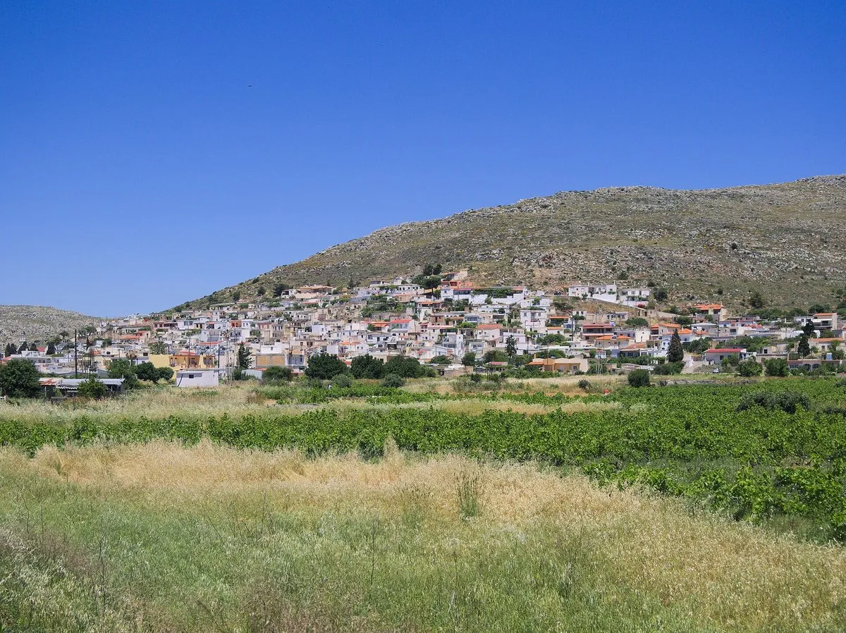
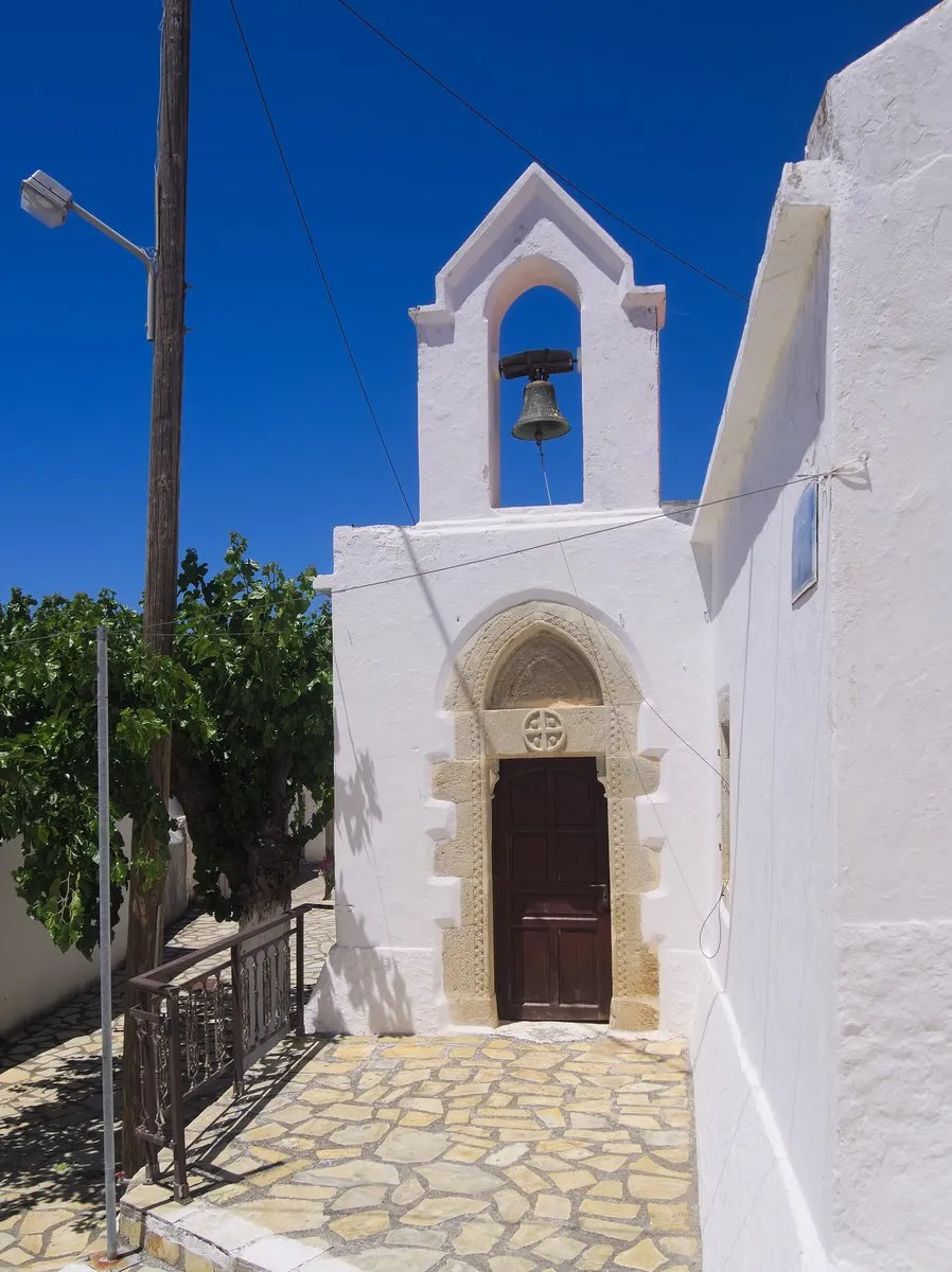
The honest half-day
Climb from the Makrigialos side mid-morning, Voila while the light rakes the ruins, Etia’s mansion facade, the Ziros square lunch as the anchor, Handras’ chapel by key-luck, and descend to Xerokampos’ coves or Sitia’s front for the swim the plateau politely lacks — altitude and emptiness converted into an afternoon’s perspective.
Getting up there
Ziros lies roughly 25–30 km south of Sitia (published figures differ), on an asphalt road that climbs through Piskokefalo, Epano Episkopi and Handras; from the south, Makrigialos is about 30 km away. The plateau sits at around 590 m, high enough to run noticeably cooler and windier than the coast. It is really two shelves a couple of kilometres apart: the western Armenohandrades plateau around Handras, and the Ziros plateau to the east.
A car is effectively essential. The routes KTEL lists from Sitia serve the coast and the main towns, so check with the Sitia station (+30 28430 22272) before counting on public transport. Ziros, with around 400 residents at the 2021 census and once the seat of the former municipality of Lefki, is where the plateau’s basic services cluster; arrive with fuel and water anyway.
What the ruins and chapels hold
Voila sits about 1 km from Handras and counted 301 inhabitants in a Venetian census of 1583. Its tower carries a date equivalent to 1742, from the Ottoman period, when it housed the local Janissary commander; the twin-naved church of Agios Georgios and Agios Ioannis holds the funerary monument of the Salomon family, with burials recorded in 1518 and 1560. The village is a protected medieval site under the archaeological service, so treat the walls as fragile and keep off them.
Etia, about 2 km from Papagianades and 22 km south of Sitia, was the seat of the Venetian De Mezzo family, whose three-storey mansion counts among the largest private houses of rural Crete; after restoration, only the ground floor survives in good condition. The village emptied in the 1950s as residents moved to nearby Armeni, and the villa has hosted a summer music festival in June — check locally whether it runs.
Across the plateau, churches including Agia Paraskevi, Agia Eirini, Agios Georgios and Agios Nikolaos keep frescoes from the 14th and 15th centuries. Walkers can add the Ziros gorge, described as the driest in eastern Crete and roughly two hours on foot: carry all the water you need and avoid summer middays.
The honest downside
There is no headline sight up here, only atmosphere in quantity — checklist travellers will finish unfed; services are minimal between squares; and summer middays bake the shadeless ruins.
Worth your time if: deserted villages and roads-to-yourself are your kind of luxury. Skip it if: the day needs guarantees — the coast’s certainties lie twenty minutes downhill.
Photos on this page: both by C messier (CC BY-SA 4.0), via Wikimedia Commons, resized for the web. Everything above was checked for the date shown at the top of this guide. Sections added in October 2026 were checked against published sources rather than on a new visit. Nobody pays to be featured in a guide — no business, no sponsor, no paid mention, ever. Adverts, where they appear, are labelled as adverts.
Tap a name to open it in your map app. These are options, not an order — pick by the day you have.
What is Voila?
A ruined village on the Handras plateau - a tower, arched doorways and two spring fountains still running. Park at the chapel and wander the lanes freely. Ten haunted, photogenic and respectful minutes is the minimum.
What is the Handras and Ziros loop?
A paved circuit from Sitia or the Makrigialos road threading Handras, Ziros, Voila and Etia - 60 to 90 minutes of driving before stops, and worth the half-day it asks with them.
What is at Etia?
A restored Venetian mansion, the De Mezzo, anchoring another semi-deserted hamlet. The exterior is always accessible; the interior keeps flexible seasonal hours.
What does lunch cost on the Handras plateau?
EUR20-35 for two, eaten among farmers in the plateia kafeneia and tavernas at Ziros and Handras. Frescoed chapels, including Agios Georgios at Handras, open via the key-next-door custom.
Why visit the Handras plateau?
It is the far easts version of the Amari valley - drier and emptier. Windmill stumps on every rise, vineyards making honest local wine, raptors on the thermals, and a shelf of land the coach maps leave blank.
How far is Ziros from Sitia?
Ziros is roughly 25–30 km south of Sitia by an asphalt road through Piskokefalo, Epano Episkopi and Handras, and about 30 km from Makrigialos on the south coast. The Ziros plateau sits at around 590 m, so it runs cooler and windier than the coast. A car is effectively essential.
One email a month — only when something on this island actually changes. No spam, no partners, one-click unsubscribe. Read past issues before you decide.