Rouvas Gorge: The Honest Guide to the Oak-Forest Climb Above Zaros
A shaded, waymarked half-day walk from the spring-fed lake at Zaros up a narrow gorge to the kermes-oak forest of Rouvas on Psiloritis. The walk itself is straightforward. Your real problem is the fire-risk closures, which apply until the end of October.
The Rouvas gorge is the walk to choose on the south side of Psiloritis if your legs can manage a steady climb but not the summit. A shaded, waymarked path runs from the spring-fed lake at Zaros up a narrow gorge to a picnic glade under old kermes oaks, and back the same way. It is not wilderness (a car road reaches the top), but the forest is real, protected and unlike anything on the north coast. The catch is timing: on very high fire-risk days a regional order closes the whole Rouvas–Zaros zone, until the end of October. This is a check of published sources (local, regional and official) made in October 2026, not a field visit.
The honest facts
- Start
- Votomos lake, Zaros (about 420–450 m), parking by the lake
- Turnaround
- the chapel and picnic area of Agios Ioannis in Rouvas forest (about 950 m)
- Distance
- roughly 10–15 km return by source; the gorge itself is about 4 km
- Ascent
- roughly 500–600 m
- Time
- about 2–2.5 hours each way; allow 4–6 hours with stops
- Waymarking
- an E4 section, signposted, with wooden steps and railings
- Water
- springs on the way and water at Agios Ioannis, but carry at least 1.5 litres each
- Closures
- closed on fire-risk category 4 or 5 days from 1 May to 31 October (Region of Crete order, 16 June 2026)
The route from the lake to Agios Ioannis
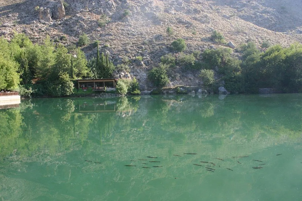
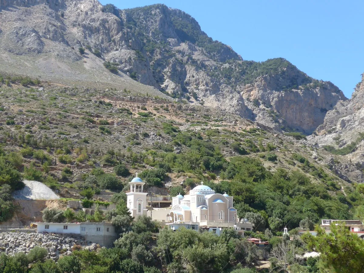
The walk starts at Votomos, the spring-fed lake covered in the Zaros guide. About 900 metres on, roughly 20 minutes, is the monastery of Agios Nikolaos, which gives the gorge one of its names; it is also called the Gafaris gorge. According to the Metropolis of Gortyna and Arkadia, a small community of monks lives there, and the church has 14th-century frescoes. Dress modestly if you go in.
Past the monastery the path enters the gorge, with the cave chapel of Agios Efthymios on its eastern edge. Higher up, a narrow section called Kakia Skala (“the bad stair”) now has wooden steps, and local descriptions mention wooden bridges and railings at the difficult points. Watch the surface: one detailed trip report warns that a good-looking path is covered in small loose stones. The climb ends at Agios Ioannis, a flat glade with a chapel, old plane trees by the stream, tables, toilets and a spring. Walk back the same way, or arrange a pickup there: a car road reaches it from Gergeri.
Sources disagree: published return figures run from 10 km in about 4 hours to 15 km in about 6. The Heraklion branch of the Hellenic Alpine Club (EOS) puts Agios Ioannis at 950 m and the lake at 450 m.
The forest and why it is protected
Rouvas is a forest of kermes oak (Quercus coccifera, prinos in Greek), not holm oak as English sources sometimes say. Some trunks exceed a metre across and some trees reach about 15 metres, mixed with maple, cypress, pine, plane and wild pear. Greek sources put the forest at about 30,000 stremmata, roughly 3,000 hectares. The Natura 2000 description of site GR4330005, “Oros Idi (Vorizia, Geranoi, Kali Madara)”, names the prickly-oak grove of Rouvas above Gergeri as the largest in the site. The area also lies inside the Psiloritis UNESCO Global Geopark. No fires or stoves; carry your rubbish down.
Fire-season closures in 2026
On 16 June 2026 the Region of Crete published its order for the 2026 fire season. It bans the passage, stay and movement of people and vehicles in listed forests on any day the national Fire Risk Forecast Map shows category 4 (very high) or 5 (state of alert). The Heraklion list includes “Rouva–Zarou”, in the municipalities of Gortyna and Phaistos. The fire season runs from 1 May to 31 October, so the ban applies throughout October. Check the map at civilprotection.gov.gr (English version available) the evening before. Walkers are not exempt. The heat, wildfire and 112 guide explains how the map works.
When to go and how it fits a day
Spring is best, when the stream runs and small pools and waterfalls form. Autumn comes second, with the heat gone and the maples turning. The Anogeia municipality’s E4 notes recommend March to October; heavy winter rain can make the stream bed harder going. In July and August, start at first light and finish before the afternoon, shade or not.
North of Rouvas the E4 continues to the Nida plateau, about 5 hours by the Anogeia notes, which is how strong walkers link this walk with the Ideon cave and Nida plateau. For the summit, see climbing Psiloritis from Nida; for the long-distance path, hiking the E4 in Crete. An easier day: lunch by the lake, then Phaistos and Gortyna on the Messara.
The honest downside
You come down the same loose-stone path you climbed, which is harder on the knees than the ascent, and the glade at the top is also a drive-up picnic spot for families, so the sense of arrival is modest. The bigger risk is a wasted trip: a category-4 day closes the zone, and the map only appears the evening before, so a booked day can fall through about an hour’s drive from Heraklion.
Worth it if: you want a shaded, waymarked walk of 4–6 hours with real forest at the top, you go in spring or autumn, and you will check the fire map the night before. Skip it if: loose-stone descents hurt your knees, you only have a hot midsummer afternoon, or you want a wild route; the lake stroll at Zaros gives the setting without the climb.
Photos on this page: Votomos lake by Bojan Cekrlic (CC BY-SA 2.0) and the monastery by Mickapr (CC BY-SA 4.0), via Wikimedia Commons, resized for the web. The guide is a check of published sources, not a site visit: distances, facilities and access were checked against the sources named for the date shown at the top of this guide. Nobody pays to be featured in a guide — no business, no sponsor, no paid mention, ever. Adverts, where they appear, are labelled as adverts.
-
The walk up — Out and back on the same path; allow 4–6 hours including stops.
1 Votomos Lake, Zaros → 2 Agios Nikolaos Monastery → 3 Rouvas gorge
Driving times are Google's own, without traffic, checked October 2026 — the shape of the day, not a promise. Allow more on mountain roads, and more again in August.
How long does the Rouvas gorge hike take?
The Rouvas gorge walk from Votomos lake at Zaros to the Agios Ioannis picnic area and back takes about 4–6 hours including stops, with published estimates of roughly 2–2.5 hours each way. Published figures for the return distance range from about 10 to 15 km.
Is the Rouvas gorge hike difficult?
The Rouvas gorge hike is moderate, not technical. It climbs roughly 500–600 m on a clear, waymarked path, with wooden steps and railings at the awkward points. The main hazard is small loose stones on the surface, so walking shoes with grip matter more than poles.
Is the Rouvas gorge open in summer and autumn?
The Rouvas–Zaros area is open on most days, but the Region of Crete's order of 16 June 2026 closes it to people and vehicles on any day the national Fire Risk Forecast Map shows category 4 or 5. The order covers the fire season, which runs from 1 May to 31 October. Check the map at civilprotection.gov.gr the evening before you go.
Is there drinking water on the Rouvas gorge trail?
Sources describe springs and fountains along the Rouvas gorge path, plus water and toilets at the Agios Ioannis picnic area at the top. The stream itself can dry up after a dry summer. Carry at least 1.5 litres per person anyway, and more in hot weather.
Can you drive to Rouvas forest instead of hiking?
Yes. The Agios Ioannis picnic area in Rouvas forest can be reached by car on a rural road from Gergeri. That makes a one-way walk possible if someone collects you at the top. Vehicles fall under the same fire-risk closures as walkers.
Is the Rouvas gorge part of the E4 trail?
Yes. The path from Zaros through the Agios Nikolaos gorge to Rouvas forest is a section of the E4 European long-distance path, which continues north to the Nida plateau. The Anogeia municipality's route notes give 19.5 km for the full Nida–Zaros stretch.
One email a month — only when something on this island actually changes. No spam, no partners, one-click unsubscribe. Read past issues before you decide.